BLOCLSchools

Broomfield School closed 31. August 1991

Broomfield School
Broom Place
Leeds
West Yorkshire
England
LS103JP

Your feedback   +


Community special school

Special classes
Has Special Classes
URN
128066
Establishment type
Community special school
Establishment #
7061
Close date
31. August 1991
OSGB coordinates
Easting: 431553, Northing: 429016
GPS coordinates
Latitude: 53.757, Longitude: -1.5229
Boarders
No boarders
Region › Const. › Ward
Yorkshire and the Humber › Leeds Central › Middleton Park
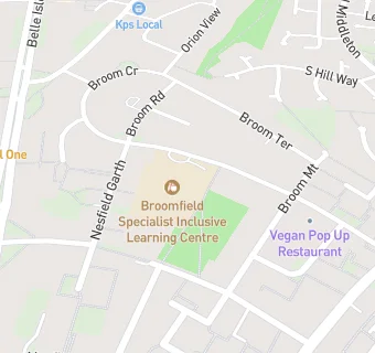
map for Broomfield School

Schools nearby

  1. Broomfield South SILC, LS103JP (219 pupils)
  2. Broomfield School, LS103JP
  3. 0.3 miles Springwell Leeds Academy, LS103JA (308 pupils)
  4. 0.4 miles Clapgate Primary School, LS104AW (458 pupils)
  5. 0.4 miles South Leeds Arts College Merlyn Rees, LS103JA
  6. 0.4 miles Clapgate Middle School, LS104AW
  7. 0.4 miles Belle Isle Middle School, LS103JA
  8. 0.4 miles Southway Independant School, LS103JA (75 pupils)
  9. 0.5 miles Windmill Primary School, LS103HQ (423 pupils)
  10. 0.5 miles Sharp Lane Primary School, LS104QE (647 pupils)
  11. 0.5 miles Belle Isle First School, LS103HQ
  12. 0.5 miles St Peter and St Paul RC School, LS104QE
  13. 0.7 miles Cockburn Laurence Calvert Academy, LS104UZ (209 pupils)
  14. 0.9 miles South Leeds High School, LS102JU
  15. 0.9 miles South Leeds Academy, LS102JU (862 pupils)
  16. 0.9 miles Cockburn John Charles Academy, LS102JU (1147 pupils)
  17. 1 mile Middleton St Mary's Church of England Voluntary Controlled Primary School, LS103SW (412 pupils)
  18. 1 mile Middleton Park High School, LS104DE
  19. 1 mile St Mary's CofE First School, LS103SW
  20. 1 mile Middleton Park High School, LS104DE
  21. 1 mile Elements Primary School, LS104WR (228 pupils)
  22. 1.1 miles Hunslet Carr Primary School, LS102DN (419 pupils)
  23. 1.1 miles St Philip's Catholic Primary School, LS103SL (264 pupils)
  24. 1.1 miles Hunslet Carr First School, LS102DN
  25. 1.1 miles St Philip's RC First School, LS103SL

🚸 schools in Leeds