BLOCLSchools

Glasbury C.I.W.(A) School closed 31. December 2012

Glasbury C.I.W.(A) School
Glasbury-on-Wye
Powys
Talgarth
Wales
HR35NU

Your feedback   +


Welsh establishment

URN
400565
Establishment type
Welsh establishment
Establishment #
3314
Close date
31. December 2012
Reason closed
Closure
OSGB coordinates
Easting: 317829, Northing: 238546
GPS coordinates
Latitude: 52.039, Longitude: -3.1994
Region › Const. › Ward
Wales › Brecon and Radnorshire › Gwernyfed
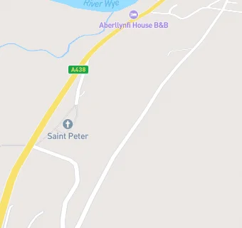
map for Glasbury C.I.W.(A) School

Schools nearby

  1. Glasbury C.I.W.(A) School, HR35NU
  2. 0.8 miles Gwernyfed High School, LD30SG
  3. 1.9 miles Ffynnon Gynydd Church in Wales School, HR35LX
  4. 2.2 miles Llanigon C.P. School, HR35QA
  5. 3.1 miles Bronllys C.P. School, LD30HP
  6. 3.1 miles Archdeacon Griffiths C.I.W. Primary School, LD30YB
  7. 3.2 miles Talgarth C.P. School, LD30BB
  8. 3.2 miles Ysgol y Mynydd Du, LD30DQ
  9. 3.3 miles Ty Bronllys, LD30LU
  10. 3.4 miles Clyro C.I.W. School, HR35LE
  11. 3.8 miles Hay-On-Wye C.P. School, HR35BT
  12. 3.9 miles Hillcrest Pentwyn School, HR35SE
  13. 5.6 miles Rhosgoch C.P. School, LD23JY
  14. 6.4 miles Melrose School, HR35TA
  15. 6.7 miles Clifford Primary School, HR35HA (86 pupils)
  16. 7.3 miles Llangors V.P. School, LD37UB
  17. 8.4 miles Michaelchurch Escley Primary School, HR20PT (65 pupils)
  18. 8.7 miles Brilley CofE Primary School, HR36JG
  19. 9.4 miles Cwmdu C.I.W. School, NP81RU
  20. 9.8 miles Ysgol y Bannau, LD39SR
  21. 9.9 miles Brecon High School, LD39SR
  22. 10.1 miles Mount Street C.P. Infants, LD37NG
  23. 10.1 miles Priory C.I.W. School, LD39EU
  24. 10.2 miles Mount Street C.P. Junior, LD37LU
  25. 10.3 miles Fairfield High School, HR20SG

🚸 schools in Talgarth