BLOCLSchools

Penny Field School closed 31. August 1991

Penny Field School
Tongue Lane
Leeds
West Yorkshire
England
LS64QD

Your feedback   +


Community special school

Special classes
Has Special Classes
URN
128057
Establishment type
Community special school
Establishment #
7023
Close date
31. August 1991
OSGB coordinates
Easting: 428941, Northing: 438011
GPS coordinates
Latitude: 53.838, Longitude: -1.5617
Boarders
No boarders
Region › Const. › Ward
Yorkshire and the Humber › Leeds North East › Moortown
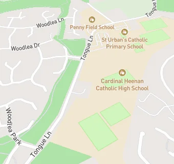
map for Penny Field School

Schools nearby

  1. St Urban's Catholic Primary School, LS64QD (211 pupils)
  2. Penny Field School, LS64QD
  3. St Urban's Catholic Primary School, a Voluntary Academy, LS64QD (200 pupils)
  4. Penny Field School, LS64QD
  5. 0.1 miles Cardinal Heenan RC School, LS64QE
  6. 0.1 miles Cardinal Heenan Catholic High School, LS64QE (923 pupils)
  7. 0.2 miles North West Specialist Inclusive Learning Centre, LS64QD (254 pupils)
  8. 0.3 miles Penny Field School, LS64QD (66 pupils)
  9. 0.3 miles Stonegate School, LS64QJ
  10. 0.4 miles Lawrence Oates School, LS72PS
  11. 0.4 miles Manor Wood Primary School, LS175DJ (501 pupils)
  12. 0.4 miles Manor Wood Primary School, LS175DJ (500 pupils)
  13. 0.5 miles Carr Manor First School, LS175DJ
  14. 0.5 miles Carr Manor Community School, LS175DJ (1484 pupils)
  15. 0.5 miles Stainbeck High School, LS175DJ
  16. 0.6 miles Meanwood CofE First School, LS64LD
  17. 0.6 miles Miles Hill Primary School, LS72RF
  18. 0.6 miles Meanwood Church of England Primary School, LS64LD (217 pupils)
  19. 0.6 miles Miles Hill First School, LS72RF
  20. 0.8 miles Moorlands School, LS165PF (144 pupils)
  21. 0.9 miles Alwoodley Primary School, LS175HX (477 pupils)
  22. 0.9 miles Bentley First School, LS64AJ
  23. 0.9 miles St Matthew's Church of England Aided Primary School, LS73QF (398 pupils)
  24. 0.9 miles Bentley Primary School, LS64AJ
  25. 0.9 miles Scott Hall Middle School, LS73QU

🚸 schools in Leeds