Whitefield Community Primary School closed - academy converter 31. March 2024
redirecting to
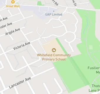
Whitefield Community Primary School
Whitefield Community Primary School
Victoria Avenue
Whitefield
Whitefield
England
M456DPWhitefield
England
👩🏫 headteacher: Mrs Katy Dickson
✉️ reveal email: m.mc…@bury.gov.ukreveal
Last updated:
Primary — Community school
- URN
- 105310
- Education phase
- Primary
- Establishment type
- Community school
- Establishment #
- 2041
- Close date
- 31. March 2024
- Reason closed
- Academy Converter
- OSGB coordinates
- Easting: 381256, Northing: 405547
- GPS coordinates
- Latitude: 53.546, Longitude: -2.2843
- Accepting pupils
- 3—11 years old
- Boarders
- No boarders
- Census date
- 18. January 2024
- Ofsted last inspection
- 18. November 2021
- Region › Const. › Ward
- North West › Bury South › Besses
- Free school meals %
- 44.10
- Learning provider ref #
- 10070100
School governors
- Mrs Katy Suzanne Dickson, Governor
(19. April 2021—30. March 2024) - Mrs Clare Cottam, Governor
(11. June 2023—30. March 2024) - Mrs Hamaira Haroon, Governor
(6. May 2021—30. March 2024) - Mrs Julie Elizabeth Keogh, Governor
(28. September 2020—30. March 2024) - Mrs Nicola Frances Wilkinson, Governor
(13. July 2020—30. March 2024) - Mr Andrew Grover, Governor
(23. February 2021—30. March 2024) - Mr Martin Griffin, Governor
(21. March 2023—30. March 2024) - The Revd John Laurie Bullas, Governor
(21. March 2023—30. March 2024)