BLOCLSchools

Ysgol Belmont closed

Ysgol Belmont
Windmill Road
Buckley
Flintshire
Buckley
Wales
CH73HA

📞 phone: 01244 *** ***


Welsh establishment

URN
401901
Establishment type
Welsh establishment
Establishment #
7014
Reason closed
Closure
OSGB coordinates
Easting: 327869, Northing: 364539
GPS coordinates
Latitude: 53.173, Longitude: -3.0806
Region › Const. › Ward
Wales › Alyn and Deeside › Buckley Mountain
Learning provider ref #
10013913
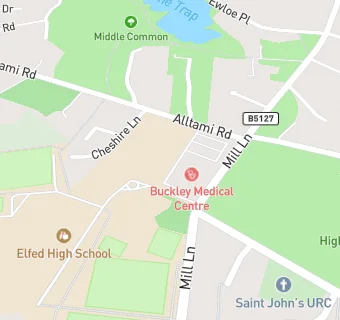
map for Ysgol Belmont

Near Ysgol Belmont

  1. Schools
  2. 0.1 milesElfed High School, CH73HQ
  3. 0.4 milesWestwood Community Primary School, CH72JT
  4. 0.4 milesMountain Lane C.P. School, CH73JA
  5. 0.5 milesBuckley Southdown C.P., CH72NP
  6. 1.0 mileArgoed High School, CH76RY
  7. 1.1 milesDrury C.P. School, CH73EG
  8. 1.3 milesYsgol Mynydd Isa, CH76SJ
  9. 1.6 milesEwloe Green C.P. School, CH53AU
  10. 1.9 milesSt Johns the Baptist V.A. Primary School, CH40EN
  11. 1.9 milesHawarden High School, CH53DJ
  12. 2.0 milesPenarlag C.P. School, CH53RQ
  13. 2.1 milesNorthop Hall C.P. School, CH76HS
  14. 2.2 milesYsgol Penyffordd, CH40LQ
  15. 2.2 milesWepre C.P. School, CH54NE
  16. 2.3 milesSt David's R.C. School, CH71LH
  17. Care Facilities
  18. ★★★★★Hawkesbury Playgroup, CH73HA
  19. Bars & Nightclubs
  20. 0.2 miles★★★★★Buckley Conservative Club, CH73ND
  21. 0.3 milesJuke Burger Buckley, CH73NL
  22. Restaurants & Cafés
  23. 0.3 miles★★★★★Mai Thai, CH72EF
  24. 0.3 miles★★★★★Legends Cafe & Catering, CH72JA
  25. Retail Stores
  26. Lloyds Pharmacy, CH73PG
  27. Allied Pharmacy Buckley, CH73PG
  28. 0.3 miles★★★★Brunswick Road Mini Market, CH72ED
  29. 0.3 miles★★★★★Spar, CH72ED
  30. 0.3 miles★★★★★Gerrards, CH72EF
  31. School Food Ratings
  32. 0.2 miles★★★★★NEWydd Catering & Cleaning Ltd, CH73HQ
  33. Takeaway Shops
  34. 0.3 miles★★★★★Buckley Fish Bar, CH72ED
  35. 0.3 miles★★★★★Buckley Tandoori, CH72JB
  36. 0.3 miles★★★★★Subway, CH72ED
  37. 0.3 miles★★★★★Crumbs Sandwich Bar, CH72ED

See all schools in Buckley