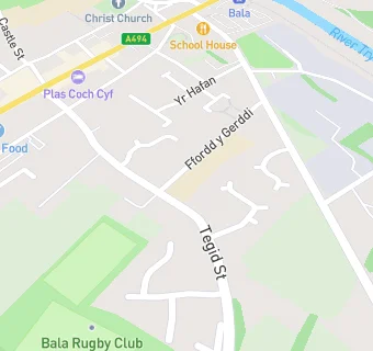
Ysgol y Parc
closed
31. August 2013
Ysgol y Parc
Parc
Bala
Gwynedd
Bala
Wales
LL237YHYour feedback +
Welsh establishment
- URN
- 400169
- Establishment type
- Welsh establishment
- Establishment #
- 2206
- Close date
- 31. August 2013
- Reason closed
- Closure
- OSGB coordinates
- Easting: 292811, Northing: 335772
- GPS coordinates
- Latitude: 52.909, Longitude: -3.5953
- Region › Const. › Ward
- Wales › Dwyfor Meirionnydd › Llandderfel

Near Ysgol y …
- Schools
- 0.3 milesYsgol Godre'r Berwyn, LL237RU
- 2.7 milesYsgol Bro Tryweryn, LL237NT
- 2.9 milesYsgol Ffridd y LLyn, LL237HE
- 4.7 milesYsgol O.M. Edwards, LL237UB
- 6.2 milesThe Branas School, LL210TA
- 8.3 milesYsgol Cerrigydrudion, LL219SW
- 8.7 milesYsgol Bro Dyfrdwy, LL210LG
- 9.3 milesYsgol Betws Gwerful Goch, LL219PY
- 9.6 milesYsgol Ysbyty Ifan, LL240NY
- 10.2 milesYsgol Pentrefoelas, LL240LE
- 10.6 milesYsgol Caer Drewyn, LL219RT
- 11.3 milesYsgol Bro Elwern, LL219DF
- 11.7 milesAran Hall School, LL402AR
- 12.0 milesYsgol Pennant C.P., SY100NT
- 12.5 milesYsgol Gynradd Carrog, LL219AW
- Hotels & BnBs
- 0.2 miles★★★★★Plas Coch Cyf, LL237AB
- Manufacturers
- 0.2 miles★★★★★Aran Hufen Ia, LL237AF
- 0.2 miles★★★★Cigydd Bala Butcher, LL237AE
- 0.2 miles★★★★★T J Roberts & Son, LL237NG
- 0.2 miles★★★★★Gwynedd Confectioners, LL237NL
- Food Trucks
- 0.2 miles★★★★★Posh Nosh Events, LL237NL
- Restaurants & Cafés
- 0.1 miles★★★★★Old Wives' Tales, LL237EH
- 0.2 miles★★★Cyfnod Cafe & Bistro, LL237AB
- 0.2 miles★★★★Hoffi Coffi, LL237AD
- 0.2 miles★★★★★Y Cwrt, LL237AB
- 0.2 miles★★★★★Y Tebot Bach, LL237AD
- Retail Stores
- 0.2 miles★★★★★Stori Beer & Wine Cyf, LL237AE
- 0.2 miles★★★★★Y Drol Ffrwythau, LL237AD
- 0.2 miles★★★★★Siop Kel Ltd, LL237AE
- Takeaway Shops
- 0.2 miles★★★★New China, LL237UR
See all schools in Bala
