BLOCLSchools

City Hospital School closed 31. August 1995

City Hospital School
School Office
City Hospital
Hucknall Road
Nottingham
Nottinghamshire
England
NG51PB

Your feedback   +


Community special school

URN
129738
Establishment type
Community special school
Establishment #
7005
Close date
31. August 1995
OSGB coordinates
Easting: 456473, Northing: 343887
GPS coordinates
Latitude: 52.989, Longitude: -1.1602
Accepting pupils
4—17 years old
Boarders
No boarders
Region › Const. › Ward
East Midlands › Nottingham East › Sherwood
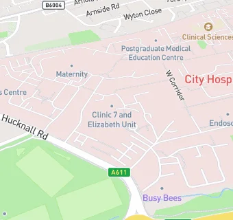
map for City Hospital School

Schools nearby

  1. City Hospital School, NG51PB
  2. 0.5 miles Seely Junior School, NG53AE
  3. 0.5 miles Seely Infant and Nursery School, NG53AE
  4. 0.5 miles Haywood School, NG53HZ
  5. 0.5 miles High Pavement Sixth Form College, NG55HT
  6. 0.5 miles Beckhampton Centre, NG56EQ
  7. 0.5 miles Hospital and Home Education PRU, NG53AE (67 pupils)
  8. 0.5 miles Seely Primary School, NG53AE (545 pupils)
  9. 0.5 miles Tlg Nottingham, NG55HN (6 pupils)
  10. 0.6 miles Henry Whipple Infant and Nursery School, NG55GH
  11. 0.6 miles Henry Whipple Junior School, NG55GH
  12. 0.6 miles Henry Whipple Primary School, NG55GH (192 pupils)
  13. 0.6 miles Beckhampton Centre, NG55SL
  14. 0.6 miles Include, NG51FH
  15. 0.7 miles Robin Hood Infant and Nursery School, NG55NA
  16. 0.7 miles Robin Hood Junior School, NG55NA
  17. 0.7 miles Padstow School, NG55GH
  18. 0.7 miles Ewing School, NG53FN
  19. 0.7 miles Robin Hood Primary School, NG55NA (487 pupils)
  20. 0.7 miles Nottingham Free School, NG51EB (624 pupils)
  21. 0.7 miles FUEL, NG51DX (25 pupils)
  22. 0.8 miles Burford Primary and Nursery School, NG56FX
  23. 0.8 miles Heathfield Primary and Nursery School, NG51JU (717 pupils)
  24. 0.8 miles Alternative Provision PRU, NG77FF
  25. 0.8 miles Burford Primary and Nursery School, NG56FX (226 pupils)

🚸 schools in Nottingham