- Blocl
- Schools
- Wrexham
The Groves High School
closed
Your feedback +
Welsh establishment
- URN
- 401718
- Establishment type
- Welsh establishment
- Establishment #
- 4047
- OSGB coordinates
- Easting: 333899, Northing: 351072
- GPS coordinates
- Latitude: 53.053, Longitude: -2.9876
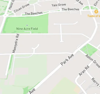
- Region › Const. › Ward
- Wales › Wrexham › Maesydre
Schools nearby
- The Groves High School,
LL127AP
-
0.2
miles Alexandra C.P. School,
LL127AZ
-
0.4
miles Rhosddu Primary School,
LL112NB
-
0.6
miles Acton Park Junior School,
LL128BT
-
0.6
miles Acton Park Infants School,
LL128BT
-
0.6
miles St David's High School,
LL139ET
-
0.6
miles Ysgol Rhosnesni,
LL139ET
-
0.7
miles Hafod Y Wern Junior School,
LL139HD
-
0.7
miles St Mary's R.C. Primary School,
LL137NA
-
0.7
miles Woodlands Children's Development Centre,
LL137NE
-
0.8
miles Erddig Nursery School,
LL137DN
-
0.8
miles Hafod Y Wern Infants C.P. School,
LL139HD
-
0.8
miles Wat's Dyke C.P. School,
LL112TE
-
0.8
miles Ysgol Plas Coch,
LL112BU
-
0.8
miles St Gile's Junior Controlled School,
LL137DG
-
0.8
miles St Gile's Infants School,
LL137DG
-
0.8
miles Ysgol Morgan Llwyd,
LL139NG
-
0.8
miles Hafod - y - Wern Community Primary School,
LL139HD
-
0.8
miles St Giles VC Church in Wales Primary School,
LL137HD
-
0.9
miles Ysgol Cae'r Gwenyn,
LL138TH
-
0.9
miles Victoria. Junior School,
LL137RP
-
0.9
miles Borras Park Infants School,
LL127TH
-
0.9
miles St Anne's R.C. Primary School,
LL138TH
-
1
mile Victoria Infants C.P. School,
LL137RR
-
1
mile Ysgol Llan-y-pwll,
LL127TH
🚸
schools in Wrexham